Its been a busy summer but I set aside the last two weeks of August to do some sailing. On Monday August 18, 2003 I set sail from Pleasant Bay, Orleans, MA bound for Nantucket with my friend Andy. Andy took the ferry back from Nantucket and I made the rest of the trip singlehanded, a total of 12 days.
Note: Logs for this trip are available at ships-log.html. Photos are available Here.
The prior day had stormy weather with strong winds from the East. That always means big waves along the Atlantic Coast. NOAA predictions for Monday initially indicated a possibility of small craft advisory, but were later revised to 15-20 knots from the North with 3-4 foot waves. By Monday morning predictions were again revised down to 10-15 knots. We had early moderate winds within Pleasant Bay, 15 knots or so. In the channel and after leaving Chatham Break, the winds decreased to 10 knots, later decreased even further.
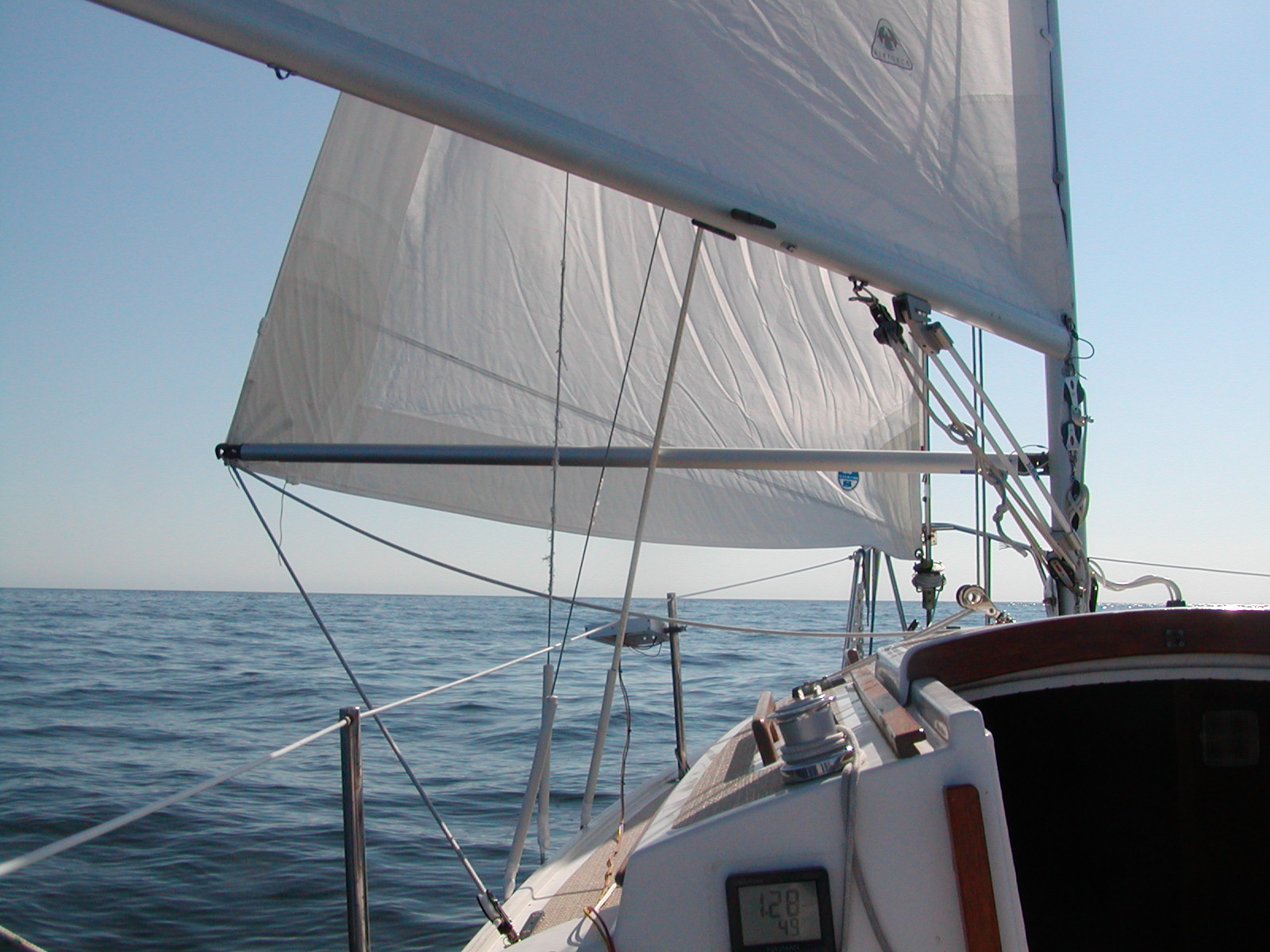
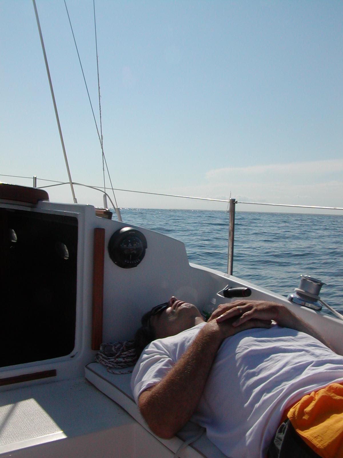
Our initial course was SSE along the shore of Monomoy Island but out far enough to avoid the shoal near the South end of Monomoy. The wind was behind us and weak and the waves were on our beam. As the winds weakened to 5 knots or so, the boat rolled a lot in the waves. Going out through the surf at Chatham Break was fun. The pitching into the waves reminded Andy to take sea sickness medication, probably too late. After an hour or two of the boat rolling, Andy started to feel seasick and I needed to handle the boat on my own. We had the jib polled out and sailing wing and wing. Due to the light wind and waves a preventer was rigged on the boom to keep it from swinging back as we rolled on the waves.
The current was in our favor. Part of the trip preparation was to time the trip for favorable current, slack at Polluck Rip or favorable current near slack, and if possible slack at Chatham Break. The wind became so weak that despite the following current we were falling behind our intended schedule. We reached Polluck Rip two hours after slack.
For those unfamiliar with the area, there are shoals between the South end of Monomoy Island and the Northeaster tip of Nantucket. These shoals can be extremely dangerous in rough seas. There are two safe passages. Polluck Rip is a narrow channel of deep water, 50 feet or more, which passes just south of Monomoy Island. Polluck Rip has strong currents and straying outside of it in rough weather can be disastrous due to the shoals. The Great Round Shoal Channel is a wide channel, two to three miles wide or more, which can be used if conditions are rough.
With the weak winds, waves had subsided by the time we got to Polluck Rip and there was no threat at all to entering Polluck Rip in the current. Waves were small enough that we could cut over Beards Shoal with its depths of 16 foot or more and save some distance. The current in the rip was already fairly strong and in our favor.
Having entered Nantucket Sound the motion of the waves was greatly reduced. Even so, Andy continued to feel seasick. The wind had also subsided further and at times was near calm. We had timed this short passage so that current would be in our favor and at this point the current was almost the only thing moving us along.
Crossing Nantucket Sound was painfully slow. We slowly approached Nantucket Harbor but well behind our schedule. We were an hour or two into full darkness when we arrived at the entrance to Nantucket Harbor, marker RW "NB".
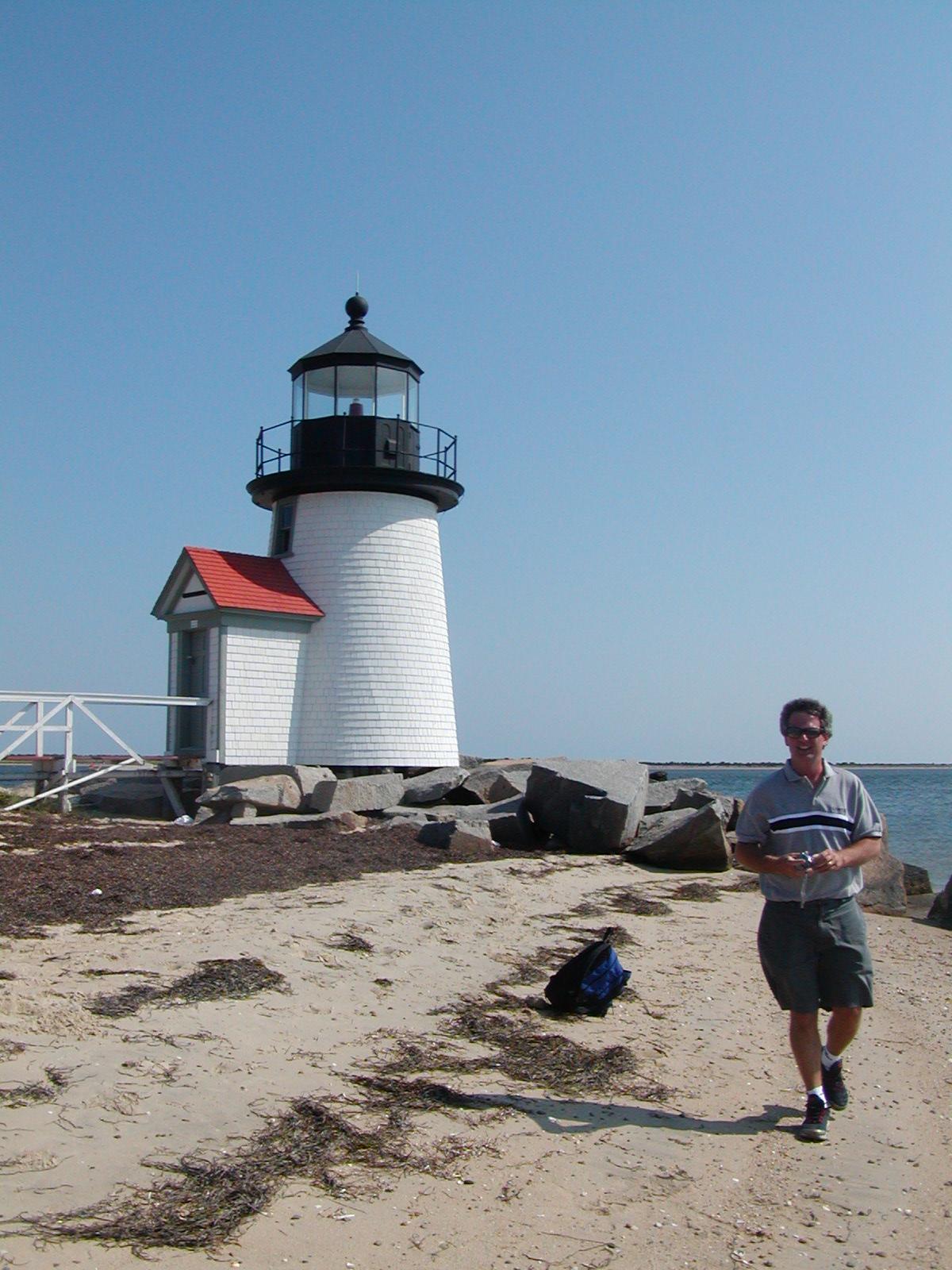
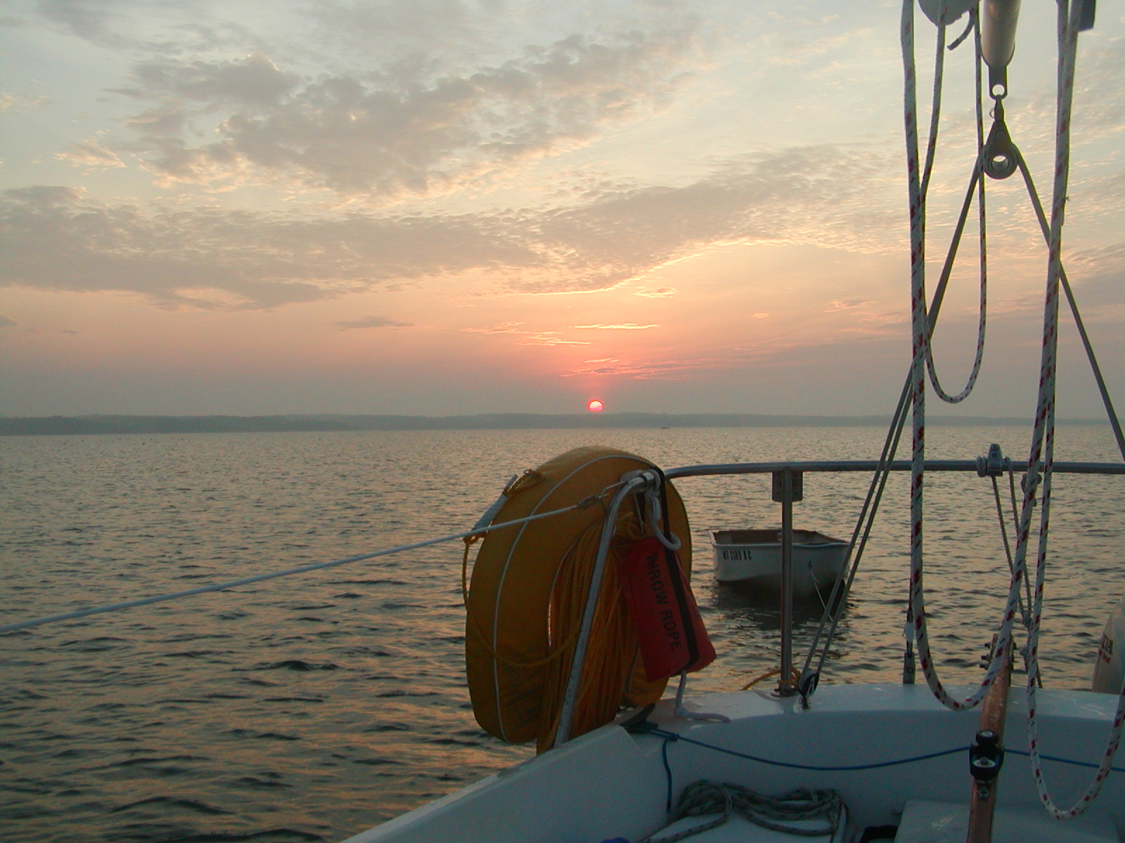
Nantucket Harbor has a jetty on either side of the dredged entrance channel. The lighted buoy just outside the channel is RW "NB". There is a light on the jetty to port, the closer of the two to the channel, and no lights on the jetty to starboard, but more room on that side. All but the final portion of the channel is straight and there are a pair of range lights. Entering is very easy using the range lights. There is a final jog to port with the end of the land sticking out into the channel marked by the well known Brandt Point Lighthouse.
It took us a while in the dark to find the place in the back of the anchorage area, well behind the mooring area, where I like to anchor. By the time we set the hook, it was 10 PM. Andy still didn't feel entirely well and decided he didn't want to sleep on the boat. He made a few phone calls from his cell phone and got a room. The launch was still running when we hailed them.

The next day we met after breakfast. Andy couldn't bring himself to go back out on the boat after feeling ill for the better part of 12 hours. We spent the day visiting the Whaling Museum, and taking a walking tour of historic places. We had a very late lunch and Andy boarded the ferry to Hyannis where he had left his car.
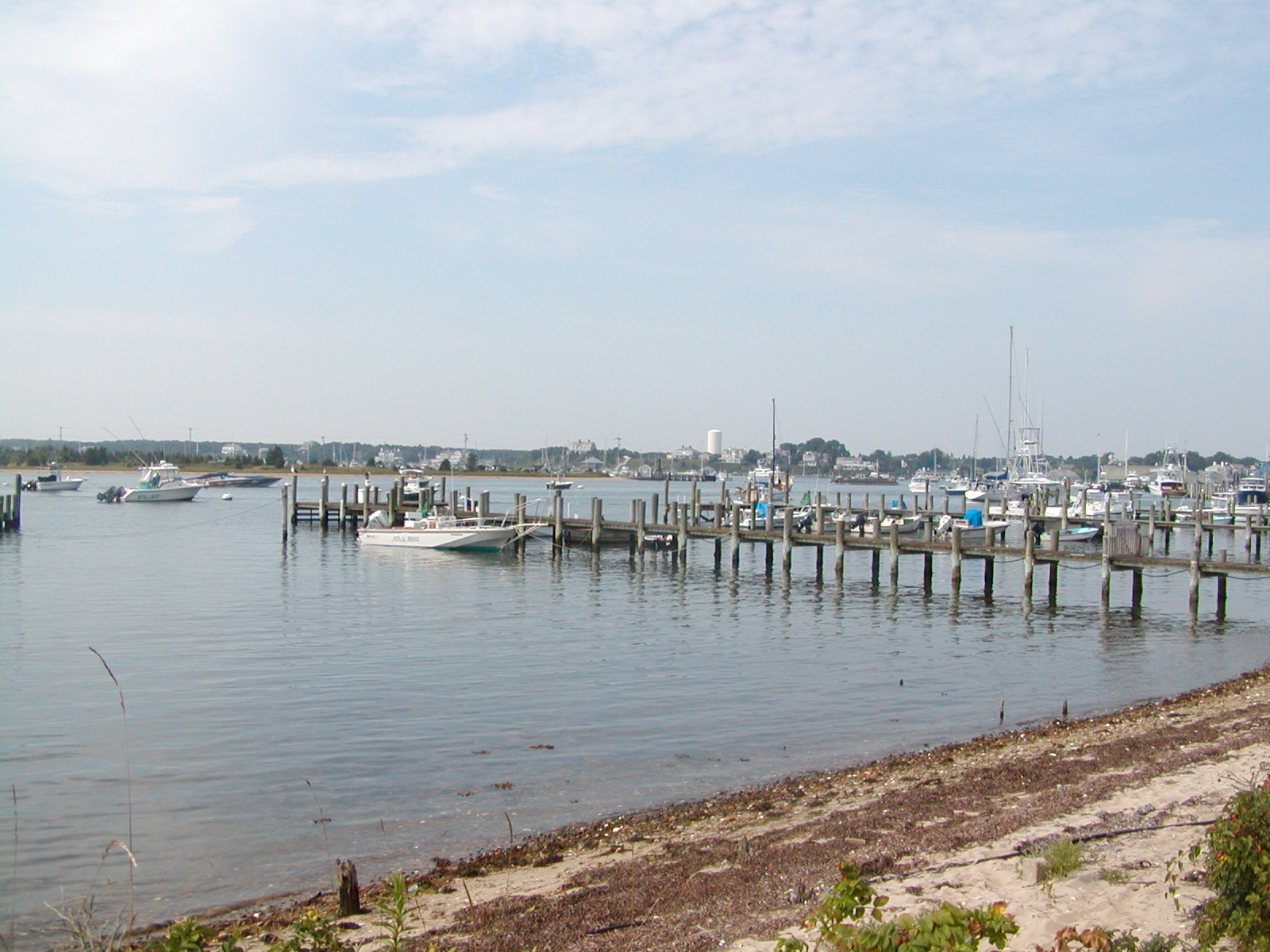
After Andy left I walked around the docks and found the showers, laundramat and the other things that are so useful for sailing. These were all located at the town dock, the one furthest into the southwest corner of the harbor. An A&P supermarket was between the town dock and the next dock to the north.
The following night was very windy. There was a lot of motion on the boat but I slept well. The 27 pound plow anchor with 40 feet of chain did its duty.
NOAA called for light wind that night and strong wind, 15-20 knots, throughout the following day. They were wrong on both counts. The next day started out with 15-20 knots of wind and steep waves from the prior night. The first two hours of sailing was a rough ride but making excellent progress to windward with the first marker within a single tack and with the current. The current remained in my favor for the next two to three hours but the wind quickly subsided and for a while nearly died. With the lack of wind I fell short of making it through Cross Rip Channel and to the turn around Cape Poge to Edgartown by some 10 miles or so before the current reversed and was opposing. The wind returned by that time but was light and for the next 6 hours very little progress was made upwind against the current. The wind gradually picked up, though still less than 10 knots and the current reversed again before I could round the northern tip of Chapaquidick, marked by the Poge Lighthouse.
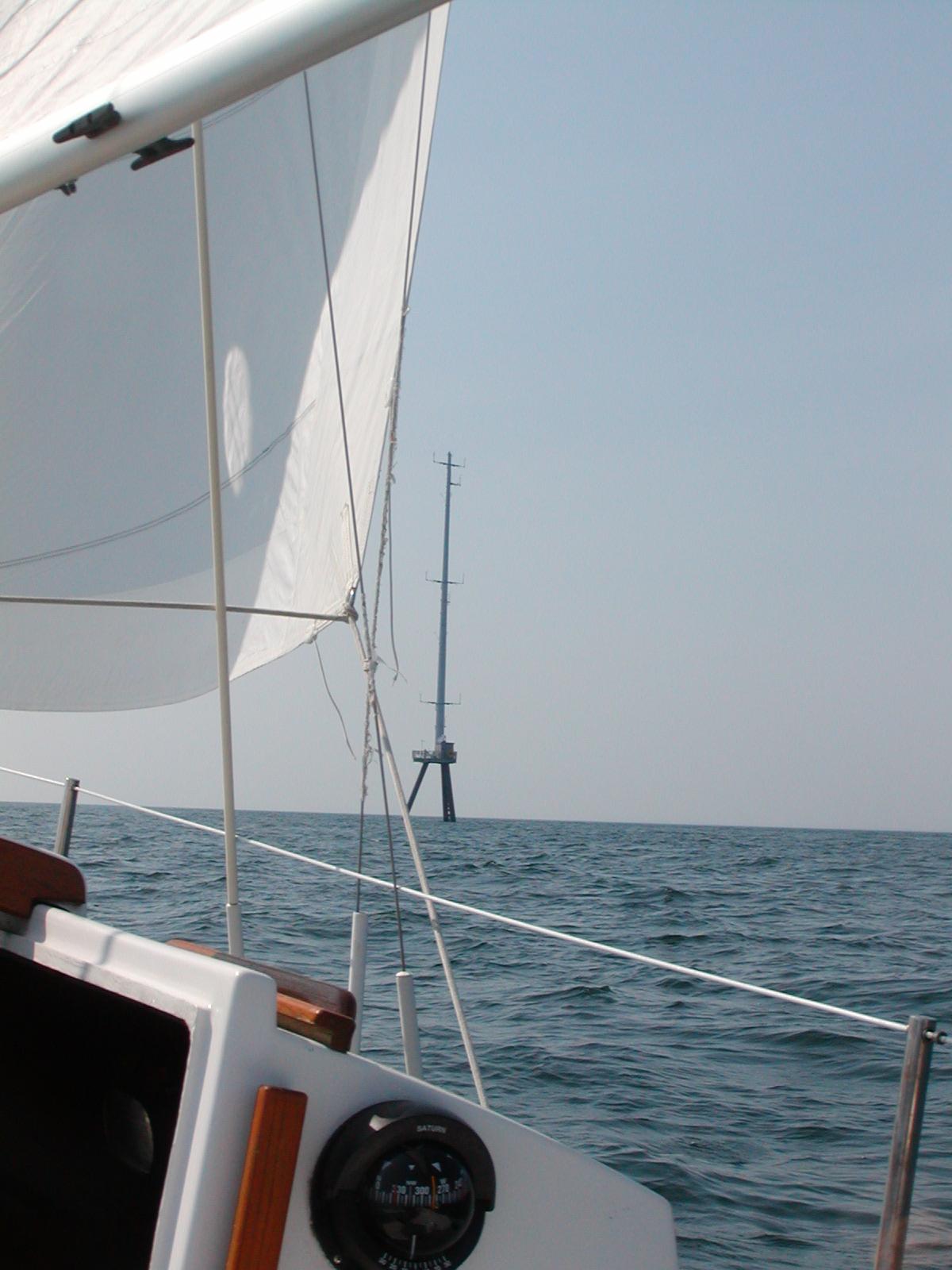
Tacking back and forth near Horseshoe Shoals brought me in the general path of a few trawlers most likely on their way back to New Bedford and not paying any attention to where they were going. Small sailboats beware. Another interesting obstacle was the meterologic tower erected by Cape Wind Associates. This is part of a very controversial project. Though it is on part of Horseshoe Shoals, the tower is very near a highly travelled channel and already in the way for small craft wishing to stay out of the way of the trawlers on autopilot in the channel on light days when staying out of the way is most difficult.
Again I arrived in the harbor late at night. This time it was Edgartown Harbor. This harbor was also not difficult to enter at night. It starts very wide with sufficient lighted markers, but I also had GPS waypoints set. It narrows and jogs to starboard, marked by a lighthouse. From that point on the harbor is very narrow but well lit by the town lights then falls into darkness beyond town.
While entering I called the harbormaster for a mooring. It was 10:00 and after normal hours but I reached the harbormaster (or someone). I was assigned a mooring but in the dark and with no one to ask for directions after the initial call I couldn't find it. Eventually I gave up looking and motored through the long narrow harbor to Katama Bay where I could anchor. The harbor was a mine field of moored boats, none of them lit. Not being able to see when I reached Katama Bay I found shallow water on the chart that was within the anchorage area but completely unoccupied due to its lack of depth. I gently grounded since it was near low tide then walked the anchor to the stern and set it there and laid the chain on the bottom along the boat. In this shallow water I was sure to be in no one's way. Even so I left the anchor light on.
The next morning I arose at first light. It was a gentle night, almost motionless and I had slept well. The tide had risen and I was now in 4-5 feet of water.
The boat battery was very low and the outboard was low on gas. I sailed back into the harbor on the faintest breeze, glad to be able to see this time. The lower harbor is full of boats with almost no channel through them. It is lined with beautiful homes, some large mansions, and has quite a bit of undeveloped land, more so on the Chapaquidick side. At that hour I had what little channel there was all to myself and a faint breeze on the beam to take me through it.
Once in the downtown portion of the harbor I found my mooring. I had just tied up when the harbormaster's assistant arrived to collect the payment. I explained the situation, the time of my call, not finding the mooring with darkness and no one to ask for further directions and asked if I could stay the following night. I was given a different mooring, not charged for the prior night and I prepaid for the following night.
This was a great spot to moor. It was a short rowing distance to the town dock. It didn't even make sense to call for the launch.
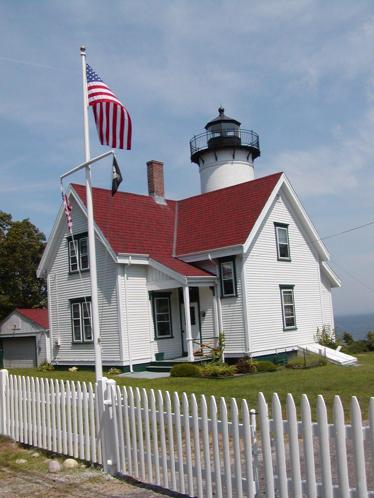
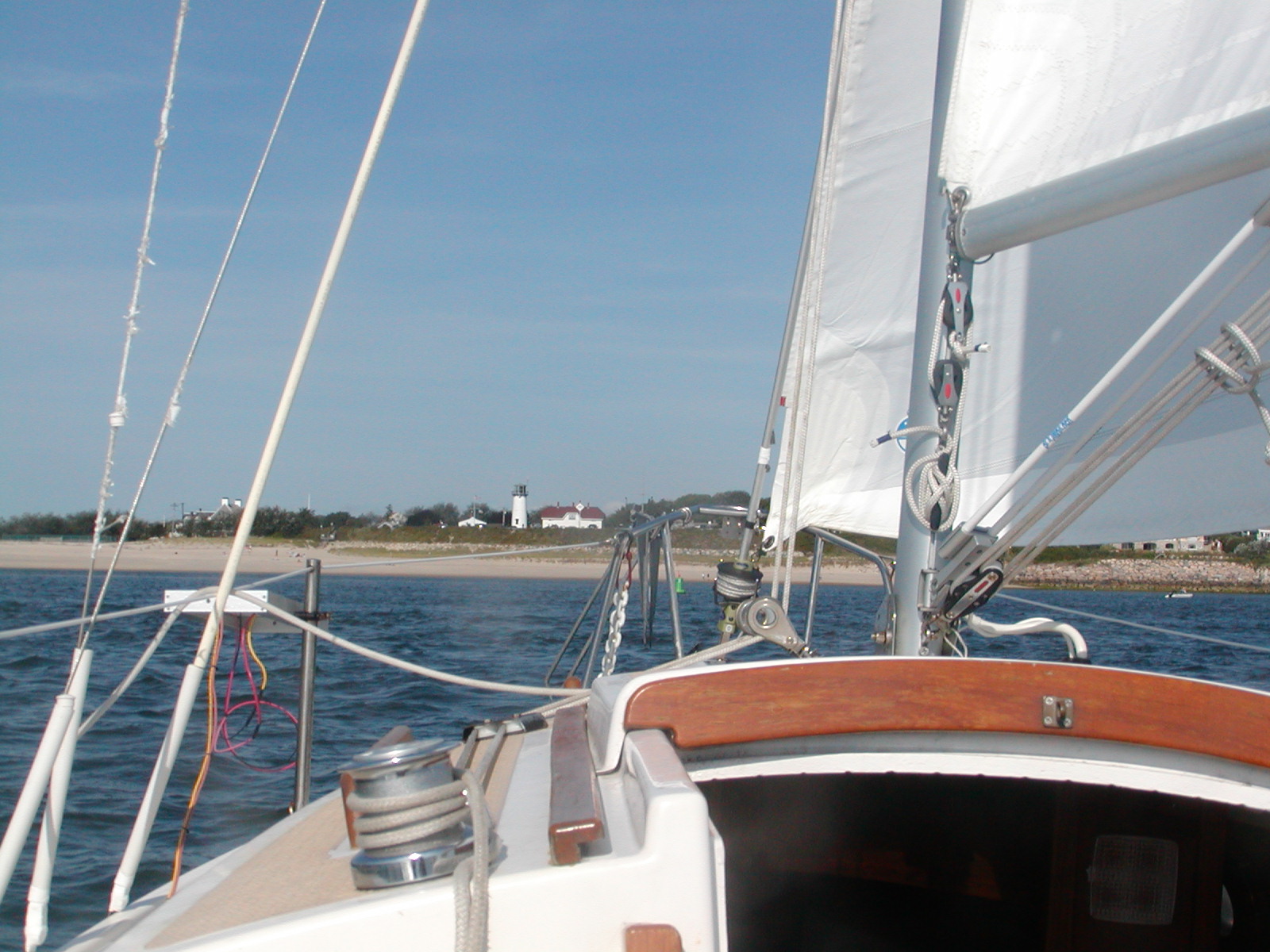
I made one stop to shower, get gas, get a few provisions, and a block of ice, and return with the gas and the ice. Once on land the second time I stopped for coffee and a bagel and then rented a bicycle. I bicycled along the coast, past some beautiful beaches, to Oak Bluffs. I went through the famous town green with its cottages, and then the crowded Oak Bluffs Harbor area, which I didn't particularly care for. I continued past East Chop among the private homes and past the East Chop Lighthouse. From there the next stop was Vineyard Haven and then West Chop and past the West Chop Lighthouse. Along the way I stopped frequently and took a lot of digital photos.
The next stop was going to be Menemsha and then Gay Head, both quite a distance from West Chop and very far from Edgartown. About a third of the way to Menemsha I realized that I might not have time to stop as I did at the other places and still get the bicycle back to Edgartown by 6 PM. I took the unpaved Tea Road, then the little travelled Middle Road to Aquidneck and then headed back to Edgartown.
I returned the bicycle at 3 PM, having not quite bicycled around the entire island of Martha's Vineyard in a day. I'm sure I would have covered Menemsha and Gay Head had it not been for the rusty squeaky rental bicycle, which had no doubt seen to much sand and salt at the beach and too little attention over the course of the season.
The next day I was reluctant to set sail even thought the next destination was close. NOAA was predicting good wind but I had just experienced nearly a 12 hour sail to Nantucket due to lack of wind and a 16 hour sail to Edgartown due to lack of wind, both on days in which NOAA predicted good wind. Furthermore they were predicting showers and thundershowers for that evening. I set sail anyway. This time the wind held. It was perfect sailing conditions, 12-15 knots the whole way. In less than 3 hours I was anchored in Vineyard Haven.
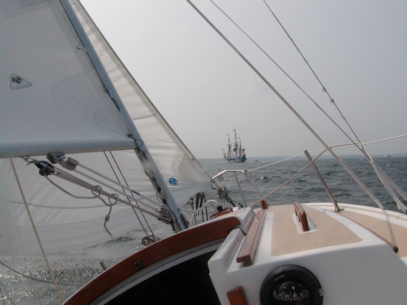
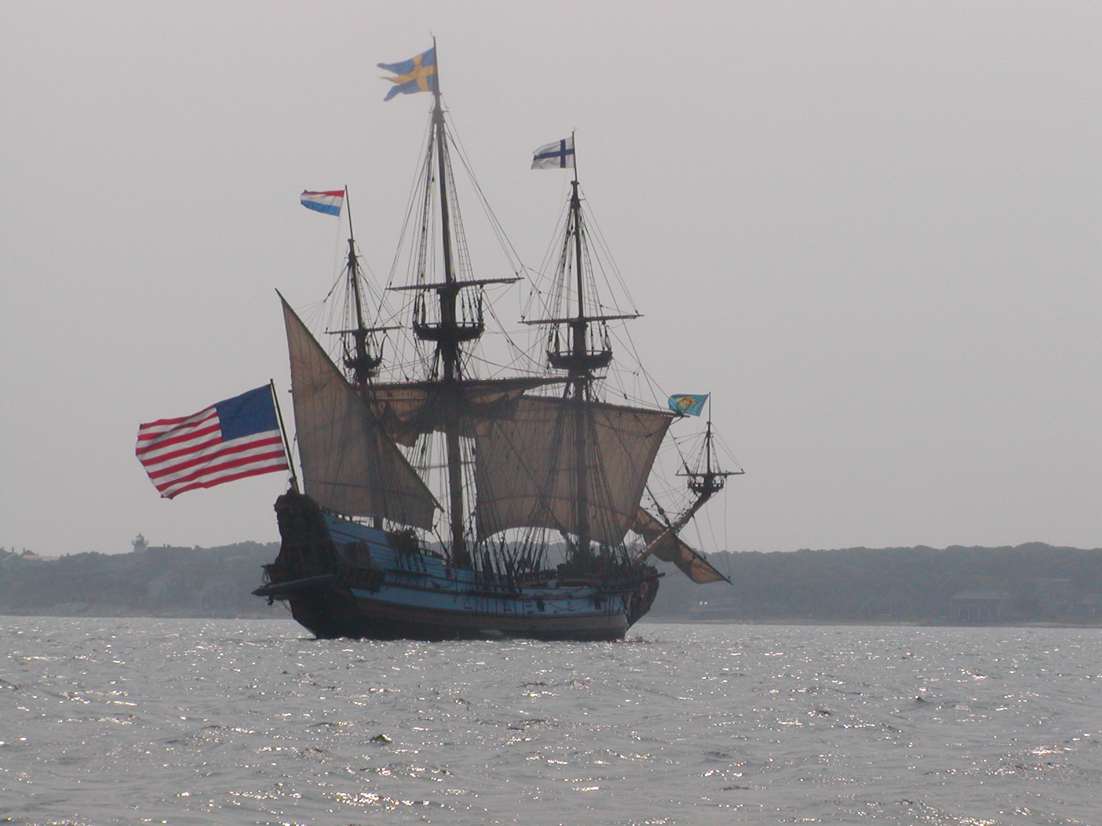
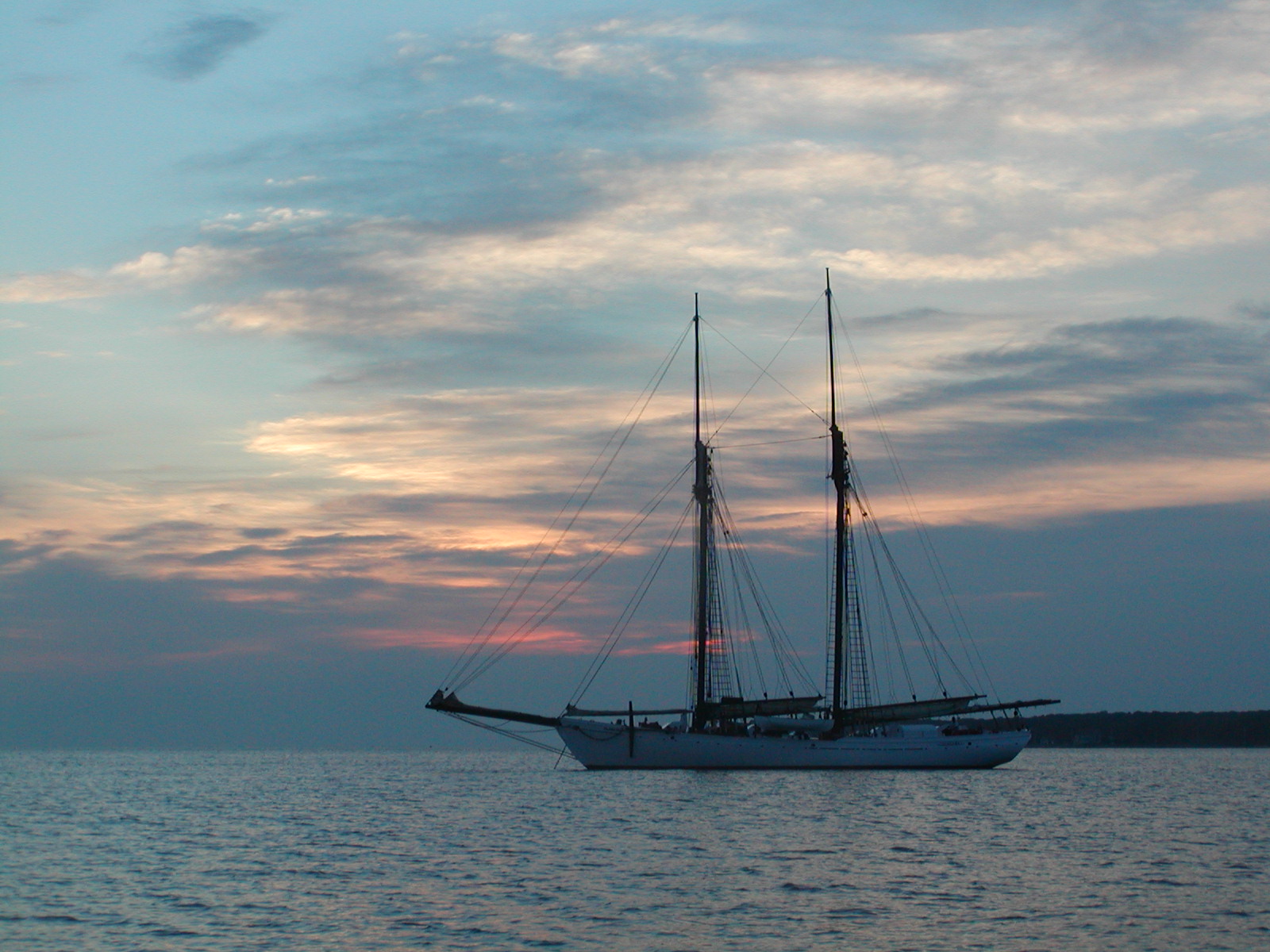
Just prior to rounding East Chop a large square rigger was sighted in the distance off West Chop. The wind had picked up a bit and the galleon was considerably slower than a CP23 on a windward course. This made for quite a few good photos. The galleon was under sail and quite slow. It was a lot of fun chasing down the larger ship and taking photos framed by my own rigging.
The galleon went on to the inner harbor and fired four cannons. It was not surprising to find out later that this ship was for hire. This ship was used for tours, daysails, and longer sails. It docked in the inner harbor and always fired the cannons just prior to docking or just prior to departing.
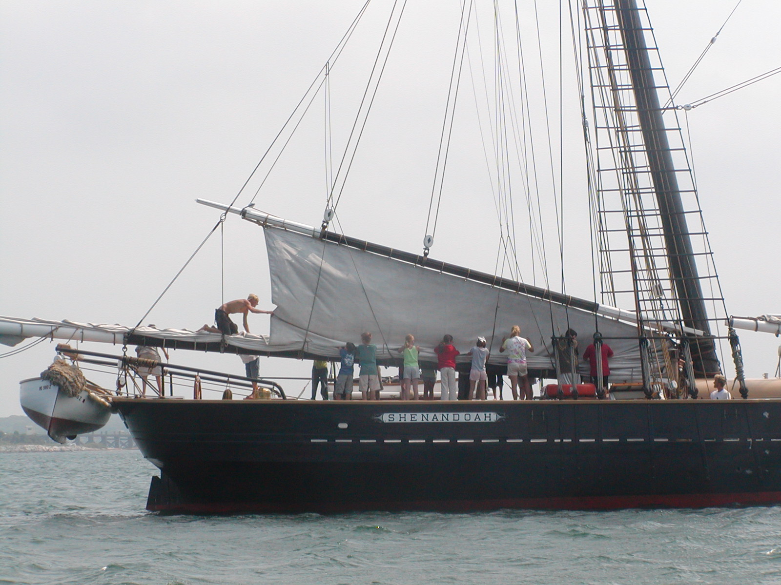
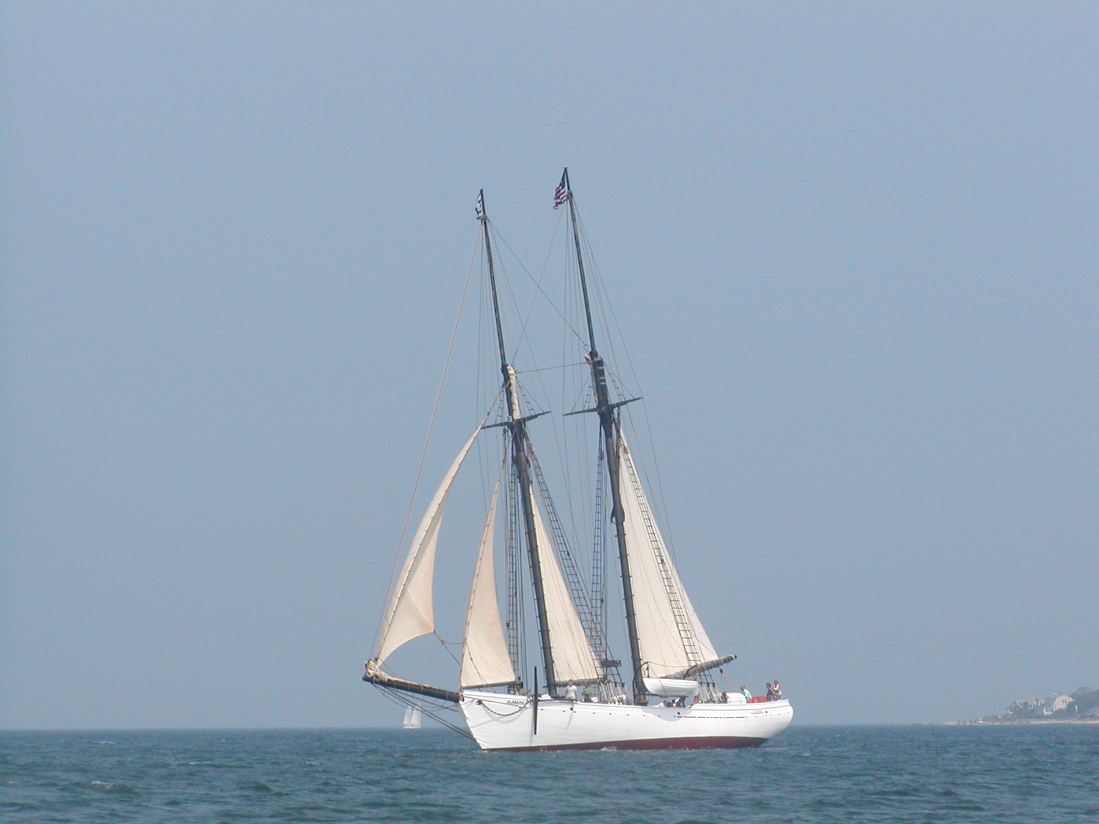
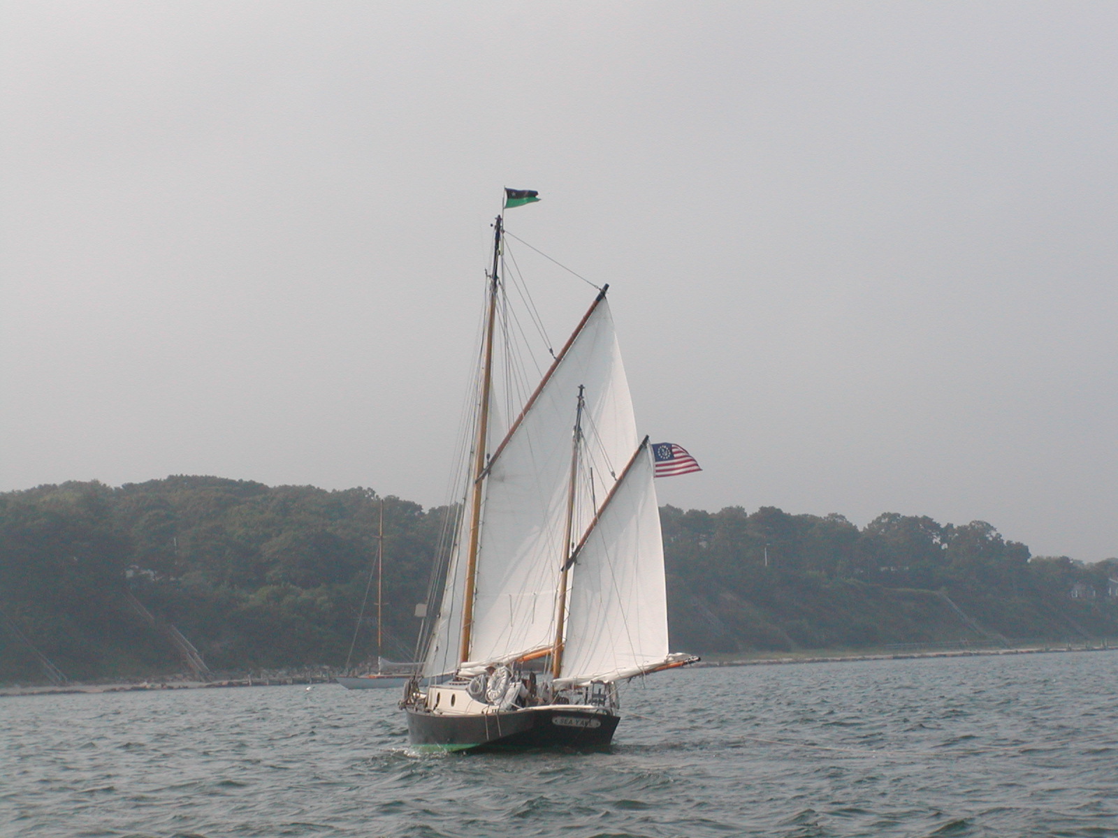
At Vineyard Haven I anchored outside the breakwater, somewhat far out. That afternoon another square rigged schooner, the Shenendoah anchored next to me, close enough that swing room was somewhat in question, and a third large schooner, the Alabama, anchored to stern of me but a ways further out. Later the small yawl name "Sea Yawl" sailed by on her way to a private mooring.
Once in Vineyard Haven, I tidied up the boat, took a nap, still tired from the cycling, and then ventured into town. I had some errands to run and I could explore the town in greater detail on foot than I could cycling through the previous day.
Normally the wind is from the SW. Because a front had just moved through the wind was supposed to be strong and from the NW. This would be perfect to sail to either Newport, RI, or to Block Island, both somewhat distant and to the SW. The current would be in my favor if I left at either about 8 AM or 8 PM. I had missed the morning window for optimal currents, and wanting to take advantage of the wind direction and strength following the front.
In the morning winds were weak. I started out at 6 AM but after a few hours upwind against the remainder of the morning's opposing current, I decided to set sail some other time when winds were stronger.
NOAA was right about the wind strength in the evening. NOAA being right happens occasionally. Winds varied but mostly were 15-20 knots with gusts of 25 knots and waves 2-4 feet.
The very beginning of the trip was dominated by the activity of dodging ferry traffic on the way out of Vineyard Haven. At one point I was near two ferries in wide open water. To avoid the closer of the two I needed to be on a tack that took me to the path of the other. Rather than try to quick tack after the first passed I hailed the other ferry long before it became dangerous. Not knowing the name I hailed "Hyannis ferry bound for Vineyard Haven near marker RW "NW", this is Remote Access, the small sailboat off your bow". I didn't get an answer to the hail but the ferry changed course, passing to my stern. Its annoying that the ferry captain just put them on autopilot and expect traffic to stay out of their way in open water in spite of navigation rules to the contrary. They certainly can't claim to be restricted by their draft in 50-70 feet of wide open water with little nearby other than one other ferry and one small sailboat.
Getting to West Chop was an upwind sail in the middle of crossing ferry traffic. Once around West Chop there were no more ferries to contend with and it was a SW course with NW to W wind through Vineyard Sound and Rhode Island Sound.
The sail through Rhode Island Sound was smooth and fast. Winds were 15 knots from the NW and in the lea of the Elizabeth Islands there was not much in the way of waves, about 2 feet. Once in Rhode Island Sound the winds picked up to 20 knots or more and waves grew to 4 feet with occasional rouges that were higher. As the winds grew I tied a reef in the mainsail. The boat pounded heavily upwind into the waves with a reef in the main and the full headsail.
For a few hours this was a fast roller coaster of a ride. Then the rowing dinghy, trailing on a line behind, flipped in a wave and was being towed upside down under the water. I needed to stop and right it. I began furling the headsail but the line bunched near the top of the furler drum and jammed a bit. I backed it up and unjammed it and then completed furling. I let the mainsail luff while I winched the dinghy full of water back and then up the stern rail to dump the water. Having emptied it, I reached back and lifted a bit by hand and flipped the dinghy over, then lowered it back into the water and let if trail behind again.
Having not held the sheets as I should after clearing the initial furler jam the headsail sheets flagged and tangled together into a mess. The initial jam had cleared but the furler was now jammed with the sail furled. This meant going to the foredeck in four foot waves. As a precaution I tied a line around my waist and to a handhold. This was a short heavy line, about 5/8, normally used in trailering. I proceeded very carefully, first untangling the sheets and then getting rid of the furler jam.
When I set sail again it was with a little less headsail to avoid flipping the dinghy quite so quickly. Hours later the wind subsided and I put out the full headsail again. Regardless, the dinghy swamped once and flipped one more time. In total I had to rescue the dinghy three times by stopping and winching it over the stern rail.
The entire sail from West Chop to Block Island was nearly a single tack. Besides tieing in the reef and rescuing the dinghy three times, near Point Judith, RI I had to tack to avoid fishing vessels on their way out. Again, regardless of right of way and even though they were not actively fishing, they had autopilots set and weren't changing them. From West Chop to Block Island was an exhausting ten and a half hours covering more than 40 miles.
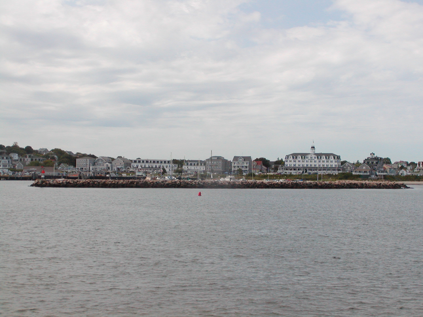
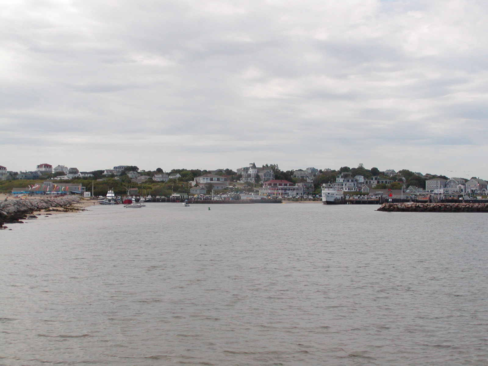
It was daybreak before I reached Block Island. I still had to round the reef at the north end of Block Island and sail down the western shore to enter the harbor. This is called the New Harbor or simply the Great Salt Pond.
Rounding the reef involved a few tacks. It was an hour sail upwind. The wind was weakening. It was a downwind sail along the western coast, more accurately a very broad reach. The wind and waves were headed directly into the harbor entrance. It was safer to lower sails and motor into the harbor so I did so.
By the time I dropped anchor it was 8:30 AM. It was Sunday morning and the harbor was still very crowded with the weekend crowd. I set the hook in nearly 40 feet of water far out in the anchorage area in the first open spot.
Throughout the morning a parade of boats exited the harbor. While I tidied up the boat the weekend crowd was leaving. The boat was a mess after the rough sail. After some tidying I took a short rest.
At about 11 AM I moved to another anchorage. At this point the anchorage area was already about half empty. The new anchorage was near shore in shallow water in the northeast side of Great Salt Pond. I then washed down the exterior of the boat and the cockpit with buckets of salt water and more thoroughly cleaned and reorganized the cabin. At some point I lay down and rested a moment.
The next thing I knew it was dark out. The clock in the cabin said 4AM. My short rest at 2 PM turned out to be 14 hours. I went back to sleep and arose again at 6:30.
At 7 AM with only a slight breeze out I started rowing the dinghy toward the town dock. On the way I ran into Aldo, the famous Italian baker who for decades has motored a small launch through the Great Salt Pond selling coffee and pastries. I got a cup of coffee and a danish and drifted along while eating breakfast. I finished rowing to the dock and walked into town.
I spent the morning walking around town and going nowhere in particular. I bought a few things I needed for the boat, sent a postcard, and had a mediocre lobster roll. The lobster roll in Vineyard Haven was infinitely better.
I walked back from town to the docks at the Great Salt Pond and rowed back to the boat. I emptied the water from the cooler and added a fresh block of ice. I read some, wrote a letter (without the aid of a computer), and went through my logs. The logs were scribbled on many sheets of paper, some of it which had gotten quite wet from spray in the cockpit. Mostly I just added dates and page numbers to the top of some pages and added a few notes to make sure it all made sense later if I didn't look at the scribble for a while after returning.
That evening I went into town again for my first and only restaurant dinner of the trip. I took a taxi so I could ask the driver about restaurant selection on the way. She was a talkative driver, very frank, and knew all sorts of details down to which hotels recently changed hands or lost a good chef. Some places she recommended for someone by themselves were the Mohegan Cafe for great food and a friendly bar atmosphere, Finns for seafood, or the National Hotel for good food and an friendly outdoor bar and tables with a great view. I went with the National. Clam chowder had corn and potatoes in it and would never make it in Cape Cod, but the swordfish was excellent. I talked to some friendly folks in the bar from RI and talked to the bartender for quite a while about sailing. Walked back and then took the launch.
Next day I started out early in the dinghy, about 6:30. I walked to town and found Aldo's bakery and Aldo's bicycle rental on the street behind Ocean Avenue. I went into the bakery to ask when the bicycle rental would open and they pointed me to someone sitting at a table who was managing the bicycle rentals. They normally open at 9 AM but after finishing his pastry he rented me a bicycle at 8 AM.
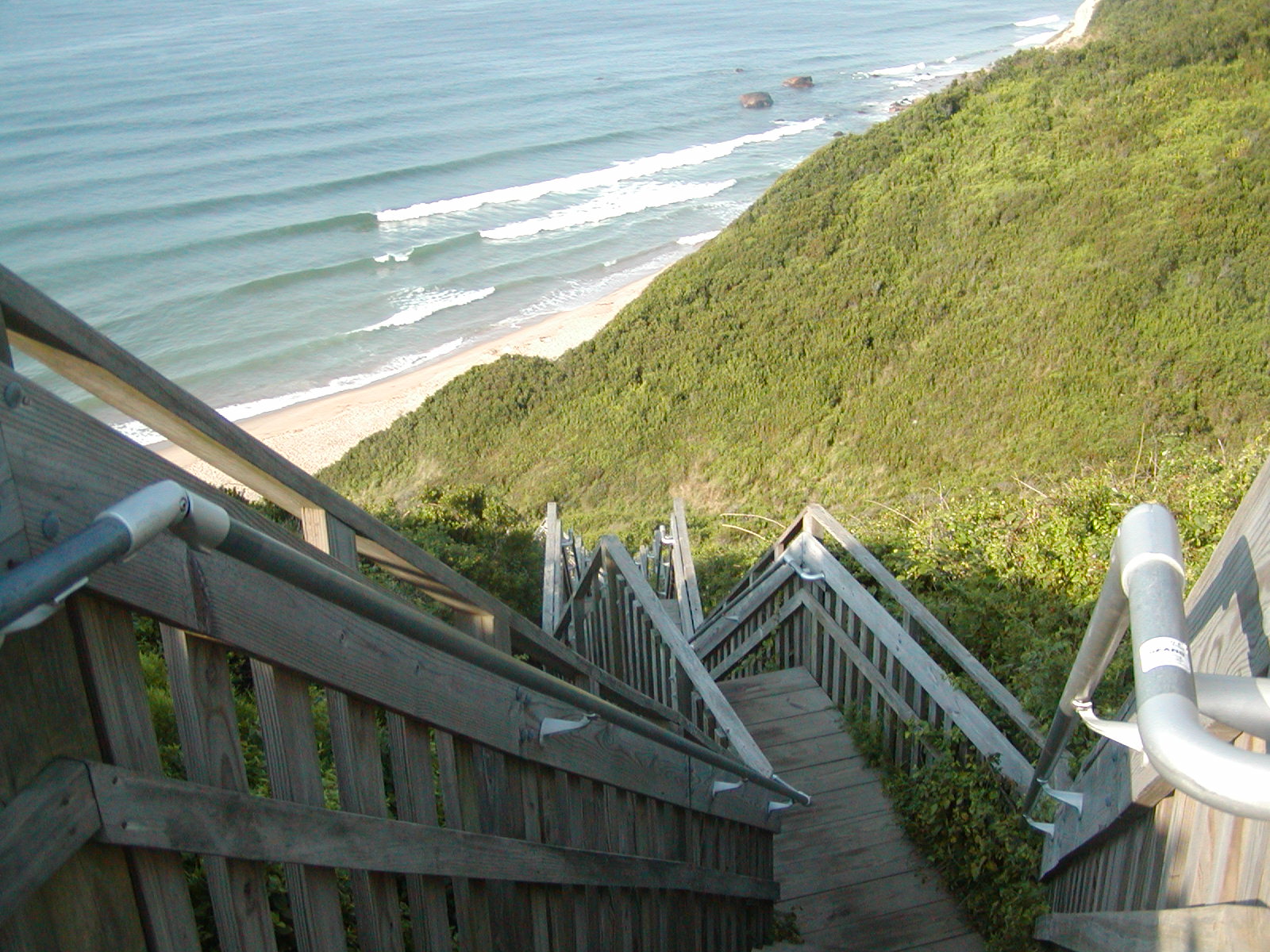
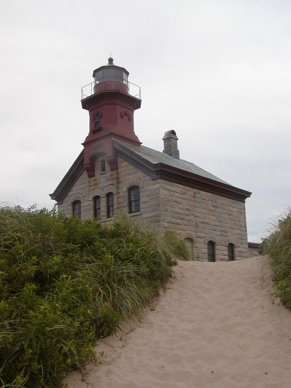
Block Island is a small island and I'm a fairly strong cyclist. I explored the whole island, every main road bordering the shore and nearly every side road and dirt path headed toward the shoreline. I took a lot of photos. The sand bluffs and empty beaches are beautiful. Block Island is 95% or more residential and the commercial district is concentrated in the remaining 5% or less, with the vast majority of tourists never leaving the commercial district. There are two major lighthouses, the Northern Lighthouse, and the Southeast Lighthouse, know also as Mohegan Lighthouse. Just south of Mohegan Lighthouse is a particularly beautiful bluff that is found by bicycling down a dirt path until reaching a "no bicycles" sign, then walking. The path leads to a set of stairs. I heard someone mention 200 steps leading to the beach, or more accurately to within 40 or 50 feet elevation from where you can walk to the beach. There were only four other people in sight the whole time I was there, not counting a couple sleeping on the beach. At many of the other beach areas there were no people at all. The only scenic place where there were quite a few people was the Northern Lighthouse, where there is a parking lot, a half mile or so walk along the beach, and a nicely restored lighthouse, with views of the water for more than 270 degrees.
That evening I needed to do laundry before going to a restaurant. I had already run out of clean T-shirts and bought one to postpone laundry a day. The only laundry available at night was at a Eureka Hotel that is an absolute dump where the fine hotels put up their summer staff. I took a taxi since I would have never found it walking in the dark. Once there I did laundry talking to two couples. Each couple was one overseas college student and one US college student, working as hotel help and had met over the summer. I also talked to another couple who were a mechanical engineering professor and a phycology PhD candidate. It helped pass the time. I then walked into town and took a shower, put on some of my nice clean but not quite dry clothes, and walked to the hotels and restaurants. They mostly looked like they were cleaning up but still open, and having had a late lunch I decided to move on and walk back rather than keep them open.
On Wednesday we had SW winds predicted to be 15 to 20 knots. The actual wind strength started out about 15 knots, was about 10 to 12 most of the day, and weakened considerably in the evening. This was a trailing wind with moderate waves, 2-3 feet and diminishing as the day went on. I started out of the harbor with a reef in the main and shook it out soon after exiting the harbor. This was a wing and wing sail with jib poled out and a preventer rigged for the whole way from the reefs just north of Block Island to the middle of Vineyard Sound. While the wind was still in the 12-15 knot range the knotlog and the GPS at one point both reported over 7 knots.
In Vineyard Sound the winds really weakened but with a favorable current. Some of this sailing was on a broad reach but most was still wing and wing. The wind picked up as I neared West Chop and was close to 10 knots again as I rounded the West Chop and tacked toward Vineyard Haven Harbor. Unlike the past weekend there were very few boats anchored outside the breakwater. I sailed in fairly close to shore and set the anchor, this time in 10 feet of water and within 100-150 yards of shore.
When I woke in the morning I rowed around the shore end of the breakwater to the harbormaster's dock where dinghies can tie up. Its conveniently near the showers. I showered and walked into town. It was still early, perhaps 7 AM. I found a great little cafe for breakfast and had an omelet and coffee. I then picked up ice, walked back, rowed back, and listened to NOAA. The prediction was for 10-15 knots, which direction seemed to depend on the forecast area, Nantucket Sound was to get SW, becoming variable and weak in late evening, stronger the next day with showers and thundershowers the next evening. I didn't want to be in a tourist mecca on Labor Day weekend so to beat the thunderstorms I decided to sail right away, possibly stopping at Chatham and taking the Monomoy Cut or possibly anchoring outside Nantucket and taking Polluck Rip after a current shift. If the wind held I might be able to make Polluck Rip before 10 PM and anchor in the Atlantic until first light and then enter Chatham Break.
The wind did not hold up. I started very light leaving Vineyard Haven, and remained light to very light in Nantucket Sound. The current reversed and I was making faint headway broad reaching in these weak winds. Wind direction was also variable. It later shifted from SW to E though still weak and varying in direction from NE to SE. I was then tacking upwind against the current, still making some progress and tacking with the wind direction changes. The wind picked up in the evening and I thought I had a shot at Polluck Rip before the current reversed and was against me. As I came within 10 miles of the entrance to Polluck Rip the wind weakened enough to make this no longer possible. Instead I headed for the Northeast tip of Nantucket where I anchored in 40 feet of open water just SW of the lighthouse.
Two and a half hours after anchoring I started out again. The time was about 3 AM. The current had wound my dinghy line around the anchor rode so it took some time to undo the mess and weigh anchor. I started out with decent wind, probably just under 10 knots into an opposing current. I made the entrance to Polluck Rip Channel about when the current slacked and and went through Polluck Rip on a slight following current. Conditions were calm enough to cut across Beards Shoal on the way back. Heading back toward Chatham Break was mostly a broad reach with occasional wing and wing sailing. The wind was sufficient that the sails held a good shape without the pole so I didn't bother to set the whisker pole. It was more a matter of being too tired to bother. Using the Chatham Lighthouse as a reference it was easy to find RW "C" and from there to find the entrance buoys.
Once inside Chatham Break and well behind Nauset, I anchored just outside the channel. It was near low tide and I wanted to wait for the tide to come in and bring some depth to the shoal near Allen Point. I anchored from 10 AM until about noon, then weighed anchor and sail the rest of the way into Pleasant Bay. By then wind had picked up to about 20 knots. It made the last leg of the trip fast but made picking up the mooring difficult.
This was the end of a long trip. At times it was exhausting. At times it was exhilarating with strong winds; other times it was frustrating with very weak winds. Throughout the trip I found it interesting and a lot of fun.
![]()